
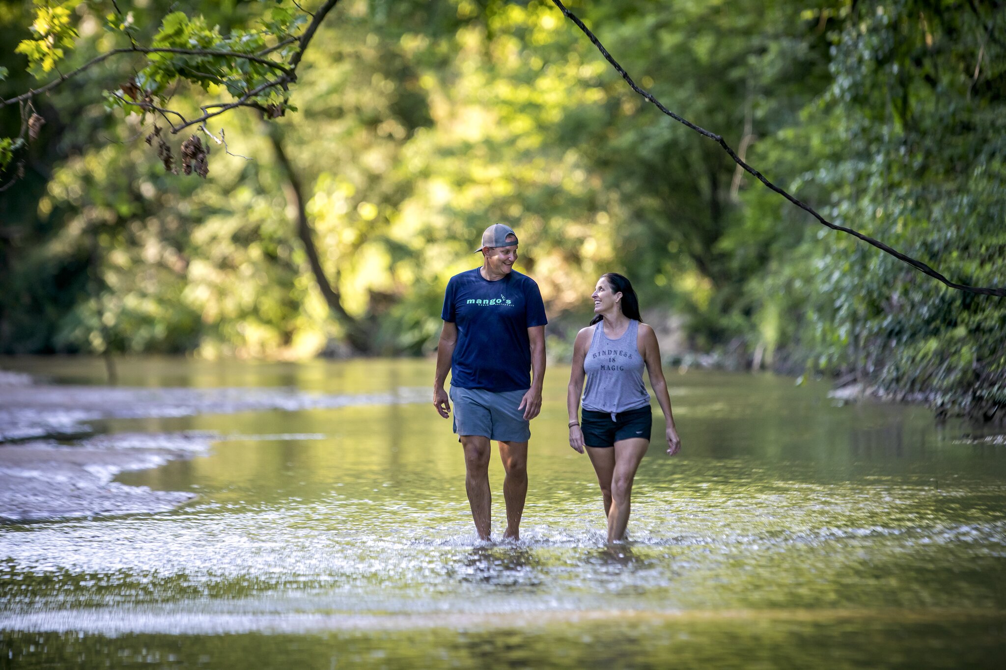
See Louisiana's wilderness up close by hiking through it!
At a Glance:
- Louisiana offers hiking experiences for all skill levels, with trails ranging from short, accessible boardwalks to long, challenging routes through forests and wetlands.
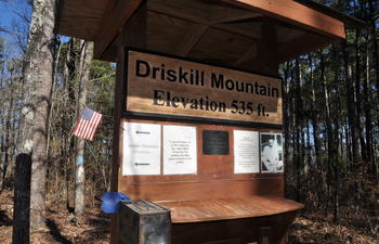
- Iconic destinations like Tunica Hills, Driskill Mountain, the Wild Azalea Trail, the Caroline Dormon Trail and the Longleaf Vista Trail showcase ravines, ridges, bayous and other aspects of Louisiana’s natural beauty and diversity.
- Families and casual hikers will find plenty of beginner-friendly options, including accessible paths, nature loops and kid-focused interpretive trails, particularly at Louisiana state parks.
- Thanks to mild winters and pleasant spring and fall seasons, Louisiana provides excellent year-round hiking conditions and abundant opportunities for wildlife viewing.
Whether you’re an experienced guide or just enjoy a nice stroll, explore Louisiana’s hiking trails for a perfect way to get outside and get some fresh air. From family-friendly interpretive sites to more difficult treks, every hiker will find a journey that suits them. So lace up your boots, grab a bottle of water and hit the trails.
Best Louisiana Hiking Trails
Louisiana State Parks Hiking Trails
Bogue Chitto State Park Hiking Trail | 7 miles | Moderate | Franklinton
In Franklinton, less than an hour north of Covington, Bogue Chitto State Park is known for its diversity of natural habitats, including small streams, cypress-tupelo swamps, a hardwood forest and even a naturally formed gorge with stunning sandstone spires. Discover these biomes on foot through a 7-mile nature trail. The quarter-mile accessible trail is also kid-friendly and features interactive, animal-themed art pieces.
Chicot State Park Hiking Trail | 20 miles | Difficult | Ville Platte
Anglers and hikers alike flock to Chicot State Park in Ville Platte, which spans more than 6,400 acres across South-Central Louisiana. Advanced explorers can attempt the 20-mile hiking trail that completely encircles Lake Chicot. The trail is dotted with primitive campsites — perfect for backpackers completing the trek.
Fontainebleau State Park Hiking Trails | 1.25 miles or 4.8 miles | Easy, Moderate | Mandeville
Looking for something beginner-friendly? Fontainebleau State Park in Mandeville features two trails suitable for newbie hikers. The 1.25-mile nature trail is great for spotting more than 400 species of birds and other animals, and the 4.8-mile hiking trail gets you close to three waterways — Lake Pontchartrain, Bayou Cane and Bayou Castine.
Lake Bistineau State Park Hiking Trails | 0.5 to 3.8 miles | Easy | Doyline
Lake Bistineau State Park’s enchanting tupelo-cypress forest provides the perfect backdrop for outdoor exploits. Choose from five hiking trails ranging from less than a mile to 3.8 miles, including a half-mile Discovery Circle trail for the kiddos.
Lake Claiborne State Park Hiking Trails | 0.5 to 6 miles | Easy, Difficult | Homer
Hikers of all levels will enjoy what’s on offer at Lake Claiborne State Park. The 6-mile White Tail Hiking Trail is a great challenge, while the half-mile Scenic Overlook Path is a short stroll to a picturesque viewing spot. Other trails include the half-mile Muscadine Hiking Trail and the nearly half-mile King of the Mountain Nature Trail.
Sam Houston Jones State Park Hiking Trails | 0.5 to 3.5 miles | Easy | Lake Charles
Sam Houston Jones State Park, named for a Texas folk hero and a former Louisiana governor, features four hiking trails. The Old Stagecoach Road is a favorite for its unique history — it’s rumored to have been used by adventurer Sam Houston himself.
Tickfaw State Park Hiking Trails | 3 miles | Moderate | Springfield
At Tickfaw State Park, visitors can explore four ecosystems — a cypress-tupelo swamp, a bottomland hardwood forest, a mixed pine/hardwood forest and the Tickfaw River. More than a mile of boardwalks will get you closer to the action, but intrepid hikers might want to venture out on the 3-mile River Trail.
This list isn’t exhaustive, and many more Louisiana state parks are home to well-loved hiking and nature trails. Check the Louisiana State Parks website for more information.
Tunica Hills

Kisatchie National Forest

Fairview-Riverside State Park
Tunica Hills
The 6,500-acre Tunica Hills Wildlife Management Area is located just north of St. Francisville. It’s a popular hiking destination from a few major cities — just over an hour from Baton Rouge and less than three hours from New Orleans. The North Tract runs along the Mississippi border, and the South Tract follows the Mississippi River, bisected by Old Tunica Trace.
Tunica Hills Hiking Trails | 3.5 to 5.7 miles | Easy to Difficult | St. Francisville
The North Tract hiking trail is a moderately challenging 5.7-mile loop through thick forest. You’ll spot resident and migratory bird species on your trek, including the worm-eating warbler and Coopers hawk. Look out for Louisiana black bear tracks, too!
The South Tract features three trails. Trail A runs just over 4 miles through deep woods and mysterious bayous. Trail B is slightly shorter, at around 3.5 miles, with a short nature trail included in the distance. As you hike, look out for native plants marked by handwritten wooden signs. Trail C encompasses just over 3.5 miles and is well-marked with orange blazes..
If you’re planning on hiking in Tunica Hills, you’ll need a self-clearing permit. You can check in and check out with the Louisiana Department of Wildlife & Fisheries app or website, or use one of the permit stations at the park. Get a map of Tunica Hills Wildlife Management Area.
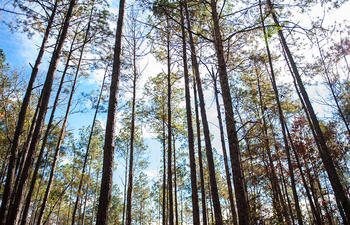
Hiking Trails in Kisatchie National Forest
If you ask a Louisiana local about the best hiking trails, they’ll probably mention Kisatchie National Forest. This natural beauty is spread across seven parishes in Central and North Louisiana. With more than 320 miles of designated hiking trails, both experienced and novice hikers will find the perfect trek.
Caroline Dormon Trail | 10 miles | Difficult | Natchitoches Parish
The Caroline Dormon Trail, named for Louisiana’s pioneer conservationist and Kisatchie National Forest co-founder, runs just over 10 miles point-to-point. It’s moderately challenging, with some climbs and sometimes rugged conditions, and be ready to share the trail with cyclists and horseback riders!
Wild Azalea Trail | 31 miles | Difficult | Alexandria Area
Whether you’re searching for the beautiful wild azalea or planning an overnight (or two) backpacking trip, the Wild Azalea Trail is a stunning 31-mile destination for bikers and hikers. Enjoy scenic vistas of pine-laden hills and hardwood bottoms, and in the spring, the trail is drenched in pink and white, thanks to its namesake.
Valentine Lake Trails | 1.2 to 1.6 miles | Easy | Rapides Parish
Looking for something less intimidating? The Valentine Lake trails are less than 2 miles each, with gorgeous lakeside views and easy access from the Recreation Complex. The 1.6-mile Valentine Lake Loop Trail starts along the north shore of Valentine Lake, then circles through a variety of ecosystems, and the Valentine Lakeshore Trail is an easy 1.2-mile out-and-back along the southern lakeshore.
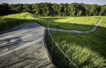
Longleaf Vista Interpretive Trail | 1.5 miles | Easy | Natchitoches
The Longleaf Vista Interpretive Trail is a family favorite, traversing 1.5 miles from meadows to bottomland hardwoods, high mesas and shallow creeks. The trail is fairly easy, with a couple of hills, and the views of Kisatchie alone are worth the trek.
Before you hit the trails, check the U.S. Forest Service website for important information, including alerts and fire danger status. Get a map of Kisatchie National Forest.


Search Places
Filter Results:
Showing results 1 - 1 of 1


The Queen Baton Rouge offers a royal experience to each of our guests. This landside casino has…


The French Market District, established in 1791, spanning six blocks in the historic French Quarter…

Lakes & Beaches
Parks & Nature
State Parks
Swamps
Biking
Birding
Boating
Camping
Canoeing & Kayaking
Golf
Hiking
Travel Services
Visitor Information
Welcome Center
Swamp Tours